By Karen Chapple, Ate Poorthuis, Matthew Zook, and Eva Phillips
Environment and Planning B: Urban Analytics and City Science
June 2021
The new availability of big data sources provides an opportunity to revisit our ability to predict neighbourhood change. This article explores how data on urban activity patterns, specifically, geotagged tweets, improve the understanding of one type of neighbourhood change—gentrification—by identifying dynamic connections between neighbourhoods and across scales.
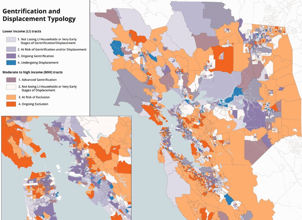
The article first develops a typology of neighbourhood change and risk of gentrification from 1990 to 2015 for the San Francisco Bay Area based on conventional demographic data from the Census. Then, the authors use multivariate regression to analyze geotagged tweets from 2012 to 2015, finding that outsiders are significantly more likely to visit neighbourhoods currently undergoing gentrification. Using the factors that best predict gentrification, the authors identify a subset of neighbourhoods that Twitter-based activity suggests are at risk for gentrification over the short term—but are not identified by analysis with traditional census data.
The findings suggest that combining Census and social media data can provide new insights on gentrification such as augmenting our ability to identify that processes of change are underway. This blended approach, using Census and big data, can help policymakers implement and target policies that preserve housing affordability and protect tenants more effectively.